Fleet Geofencing: How It Works and How to Implement It
Geofencing uses GPS location data to trigger an alert or an automated workflow when a vehicle enters, exits or stays inside a boundary you define. Here is how the technology works, where fleets get the most out of it and how to implement it without burying your team in notifications.
Apr 4, 2023 | Updated: Sep 14, 2026
21 min read
What you need to know
- A geofence is a trigger. GPS tracking shows you where an asset is. A geofence turns a location into an event, then turns that event into an alert, a timestamp or a status change.
- Most fleets already own the hardware. If your assets report position through telematics or a mobile app, geofences are software-defined boundaries drawn on data you already collect.
- Start with five locations. A handful of geofences tied to real cost leakage will outperform a map covered in boundaries nobody reviews.
- Every trigger needs a decision behind it. If nobody will act on an entry event, log it passively instead of alerting on it. Alert fatigue is the most common reason geofencing programs quietly die.
- Transparency separates accountability from surveillance. Tell drivers what is tracked and why, and geofence records become the evidence that protects them in a dispute.
Geofencing uses GPS location data to trigger an alert or an automated workflow when a vehicle enters, exits or stays inside a boundary you define. That is the entire mechanism. No physical equipment at the site, no driver action, no phone call.
For years geofencing sat in the category of features fleets bought and never configured, a checkbox on a telematics contract that someone meant to get to eventually. That has changed, and the pressure driving it is operational. Fleets are running with fewer dispatchers and supervisors than they had five years ago. Fuel and maintenance costs have made unauthorized mileage and idle time expensive enough to chase. Insurers and legal teams now expect a documented record of where an asset was and when it got there.
Geofencing answers all three at once, because a location event is a fact that arrives without anyone asking for it. Arrivals post themselves, so a supervisor stops calling four drivers for status updates. The log shows whether a unit ever left the yard. A safety team reviewing an incident works from a timeline that already exists.
This guide covers how geofencing actually works, the benefits worth building a program around, the use cases fleets get the most out of, a phased implementation plan and the mistakes that cause geofencing to fail. It is written for fleet managers, operations leaders and safety teams.
How Geofencing Works In Fleet Operations
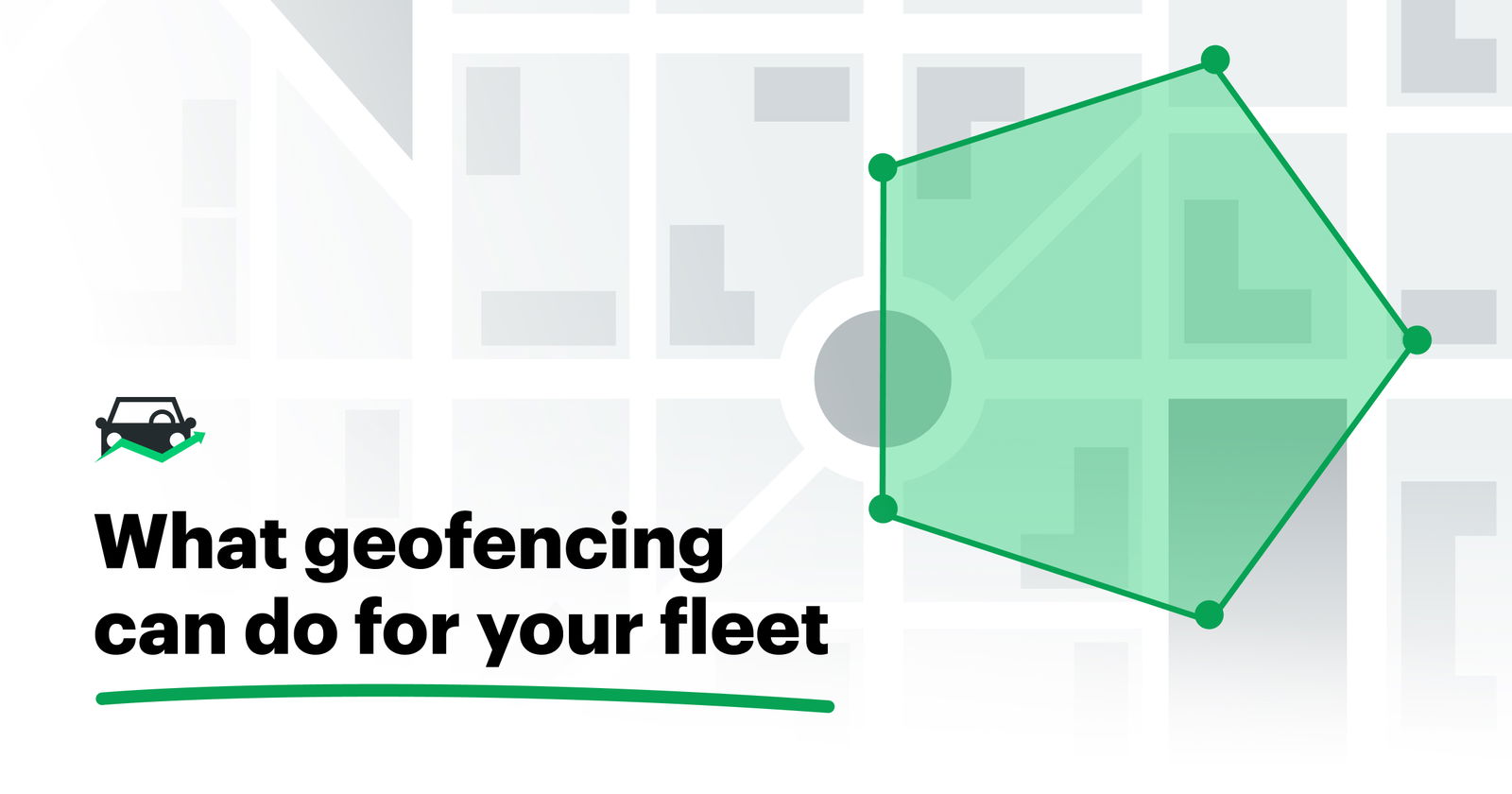
A geofence is a virtual boundary you draw around a real location. When an asset crosses that boundary, your fleet software records an event and does whatever you told it to do: send an alert, stamp a time, update a status.
The process has three parts. GPS satellites determine where the asset is. A telematics device or mobile app transmits that position to your platform. Your fleet software compares the position against your boundaries and turns matches into events and reports. Nothing in that chain requires equipment at the location itself, and nothing requires the driver to remember anything.
Whether it works well comes down to GPS signal conditions, how often the device reports and how carefully you configured the rule.
The technology behind fleet geofencing
GPS-based geofencing is what nearly every fleet uses. A receiver in the vehicle calculates position from satellite signals. The telematics unit or driver app pushes that position upstream on an interval, and the platform evaluates it against your geofences. Because the boundary lives in software, you can draw one around a customer site you have never visited and it works the same day.
RFID-based geofencing exists but solves a narrower problem. It requires readers installed at fixed points, which means it only works where you have already spent money on infrastructure. Where it earns its place is short-range precision: gate access, bay-level tracking inside a shop or parts movement in a warehouse where GPS cannot resolve the difference between two locations 15 feet apart. For fleet vehicles moving across a service territory, GPS is the answer.
Three variables decide whether your geofence events match reality:
- Signal conditions. Parking decks, tunnels, dense downtown blocks and heavy tree cover all degrade position accuracy. A geofence drawn tightly around a loading dock under a canopy will produce events that look wrong because the position data is wrong.
- Update frequency. A device reporting every 15 seconds catches a boundary crossing almost immediately. One reporting every five minutes may log an arrival long after the vehicle parked, or miss a quick pass-through entirely.
- Rule configuration. Radius, dwell threshold and which events trigger notifications are all your decisions. Most geofencing complaints trace back to configuration rather than technology.
What happens when a vehicle crosses a geofence
Geofence logic runs on three basic conditions. An entry event fires when the asset crosses into the boundary. An exit event fires when it leaves. A dwell time threshold fires when the asset stays inside longer than a duration you set, which is how you catch a 40-minute stop at a site that should have taken 10.
Each condition can drive a different response. An entry at a customer site might notify a dispatcher and stamp a job start time. An exit from the yard after hours might page a supervisor. Dwell time past a threshold might flag a job for review rather than interrupt anyone.
The operational value is that all of this happens without a check-in. The driver does not open an app, place a call or mark a job complete. Their arrival is the input. The gain is consistency more than accuracy: manual check-ins get skipped on busy days and forgotten at the end of long ones, while a geofence event posts the same way on every shift.
Common types of geofences fleets use
| Type | Best for | Tradeoff |
|---|---|---|
| Circular | Single-address sites, quick setup at scale | Includes area you did not mean to include |
| Polygon | Irregular yards, campuses, multi-building sites | Takes time to draw and maintain |
| Permanent | Depots, yards, offices, recurring customer sites | Needs review when a location changes |
| Temporary | Construction projects, seasonal work, short-term contracts | Needs an owner and a retirement date |
| Route or corridor | Fixed-route operations with exception policies in place | High false-positive rate without mature policies |
Circular geofences are a radius around a point, which makes them fast to create and good enough for most single-address locations. Polygon geofences let you trace an actual perimeter, which is what you want for an irregular job site, a campus with multiple buildings or a yard where the far corner sits across a public road you do not want inside the boundary.
Permanent geofences cover the places your fleet returns to indefinitely. Temporary geofences cover the ones that will not exist in six months, and they are the ones fleets forget to remove. Assign an owner and a retirement date when you create one.
Route and corridor monitoring is the advanced option, and it deserves restraint. Alerting whenever a vehicle deviates from an expected path sounds useful until traffic, construction detours and a legitimate reroute generate more exceptions than anyone can triage. Use it when you have written policies about acceptable deviation and a team ready to work the exception queue.
Benefits of Geofencing for Fleets
The benefits are easier to see when tied to a workflow. Each one below replaces something a person currently does by hand.
Operational visibility and administrative efficiency
The clearest change is the disappearance of the status call. Supervisors who spend their morning asking drivers where they are, and their afternoon relaying that to customers, stop needing to ask. Arrivals and departures post themselves, and dispatch works from a current picture instead of a reconstructed one.
The time saved is real, though it is not the main return. What changes is the mental overhead of holding a fleet's position in your head. A supervisor tracking 20 assets across a territory is running a continuous background process of who is where and who is probably late. Geofence events retire that process, which frees attention for the work that actually needs judgment.
Coordination improves in a specific way too. Dispatch, field supervisors and customer-facing teams all read the same event log, so nobody is relaying secondhand information. When a customer calls asking where the technician is, the person answering the phone has the arrival time in front of them.
Asset protection and misuse prevention
After-hours movement alerts are the highest-value geofence most fleets never set up. An exit event from your yard at 11 p.m. on a Saturday is either theft, unauthorized personal use or an emergency call nobody logged, and all three are worth a notification.
Unauthorized location detection works the same way in reverse. An asset appearing somewhere it has no reason to be is a signal you cannot get any other way. Combined with vehicle location history, you also get retrospective capability: when an audit or an investigation needs to know where a unit was on a specific afternoon three months ago, the record exists.
The downstream effects compound. Less unauthorized mileage means less wear on components, which means fewer unplanned repairs and less schedule disruption. Accurate location records also narrow liability exposure, because a documented answer to "was our vehicle there" is worth considerably more than an educated guess.
Accurate time tracking and job costing
For any fleet billing by the hour or proving service delivery, automated arrival and departure timestamps replace a document that was never trustworthy. Paper timesheets get estimated, rounded, filled out at the end of the week, lost and occasionally soaked. Geofence timestamps are captured at the moment they happen.
The effect shows up differently by operation. Field service fleets get proof of service, an unambiguous record that a technician was at the address for the duration billed. In construction, job duration by site turns equipment cost allocation from an estimate into a calculation. Utility fleets get stop verification across a long service route, and municipal operations get the documented service record that answers a resident complaint or a council question.
Fewer time disputes is the underrated outcome. Disputes are expensive out of proportion to their size, consuming a supervisor's afternoon and souring a customer relationship over 45 minutes of billed labor. A timestamp ends the conversation.
Safety, compliance and risk reduction
Location-aware safety rules let you apply different expectations in different places, which is how safety actually works. A 15 mph yard where pedestrians and forklifts share space needs a tighter speed threshold than the highway leading to it. A geofence lets you enforce that difference instead of setting one fleet-wide limit that fits neither environment.
Restricted-area alerts cover the locations where presence itself is the issue: a site with hazmat controls, a customer facility with access restrictions or an area your insurance policy excludes. Incident review also gets faster, because the time and place context is already assembled. Instead of reconstructing a timeline from a driver's recollection and a dispatch note, the sequence is in the log.
This works as a preventive control, and it stops working the moment it reads as surveillance. The fleets that get value here alert on exceptions, tell drivers exactly what triggers a notification and use the data to coach rather than to catch. Geofencing supports a driver safety program and cannot substitute for one.
Know when and where assets go
Use geofences to monitor asset movement around job sites, yards and other key locations — and get alerted when something moves outside the boundaries you set.
Book a demo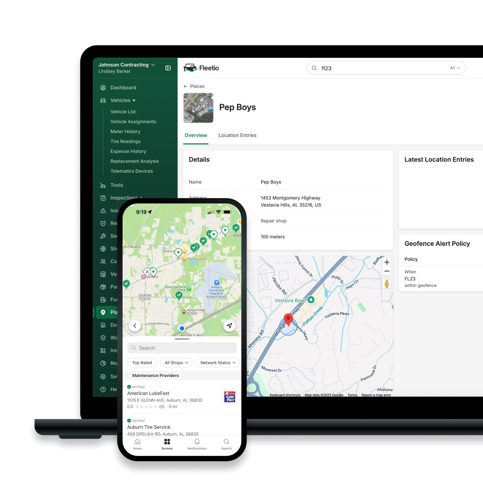
Common Fleet Geofencing Use Cases
Job sites and customer locations
The problem. A service fleet running 18 technicians fields a steady stream of "where is my tech" calls and, once or twice a month, a customer who insists nobody showed up. The office has no record either way, so the invoice gets credited.
The geofence. A boundary around each recurring customer address, with entry and exit events logged and a dwell threshold flagging jobs that run well past estimate.
The outcome. Arrival and departure verification ends the disputed-visit problem outright. Dwell time data shows which job types consistently exceed their estimate, which usually points at the estimate rather than the technician. For fleets working under service level agreements, the event log becomes the SLA report instead of something assembled by hand each month.
Yards, depots and warehouses
The problem. A construction fleet cannot account for equipment between projects. Units get moved between yards without paperwork, and the Monday morning question of what is actually on site takes two phone calls to answer.
The geofence. Polygon boundaries around each yard, with exit alerts outside scheduled hours and all entries and exits logged passively.
The outcome. After-hours movement gets flagged while it is still happening. Beyond security, the entry and exit pattern reveals yard flow problems nobody had data on: assets queuing at a single gate, a check-in process that adds 20 minutes to every return, trailers sitting for days waiting on a handoff. Pairing geofence data with asset tracking also smooths the transition between yard and road operations, because both sides are working from the same record of what left and when.
High-risk or restricted areas
The problem. A municipal fleet operates in a public works yard where crews work on foot around moving equipment. Speed is the hazard, and a fleet-wide limit does nothing about the 25 mph pass through a 10 mph area.
The geofence. A boundary around the yard with a location-specific speed threshold, plus boundaries around restricted zones where entry alone triggers an alert.
The outcome. Proactive alerts on speed inside a pedestrian area create an intervention before an incident rather than a report after one. Compliance-driven locations get the same treatment: sites with access restrictions, weight-restricted routes and areas covered by permit conditions all become enforceable instead of aspirational. This connects directly to fleet compliance work, where the ability to demonstrate a control matters as much as having one.
Routes and delivery zones
The problem. A delivery operation runs 30 routes a day and only learns about a missed stop when the customer calls.
The geofence. Boundaries on each scheduled stop, with an exception raised when a route completes without an entry event at every planned location.
The outcome. Missed stop detection surfaces the problem while there is still time in the day to fix it. Unexpected detours and service zone exits show up as exceptions rather than as a variance someone notices in next week's report. On-time delivery performance improves because the failures get caught and corrected instead of accumulating.
Run this as exception-based management. Nobody should be watching 30 routes move across a map. The system watches, and the team works the handful of exceptions that need a human.
How to Implement Geofencing for your Fleet
Most geofencing rollouts fail the same way: a project owner maps 40 locations in a week, turns on alerts for all of them, and the team mutes notifications by the end of the month. The phased approach below is slower on purpose.
Step 1: Identify high-impact locations
Start where a location event would change a decision or prevent rework. That is a narrower list than it first appears, and writing it down is most of the work.
Look for three signals. Cost leakage: locations tied to unauthorized mileage, unexplained idle time or billing you cannot substantiate. Safety incidents: places where something has already gone wrong, or where the conditions make it likely. Compliance risk: sites where you need to prove presence, absence or adherence to a restriction.
Then stop. Three to five geofences is a real starting point. The pitfall here is completeness, the instinct to map every location before turning anything on. Fleets that do this cannot tell which geofences are working, because everything launched at once and everything generates noise.
Step 2: Define clear rules and triggers
For each geofence, decide whether the event warrants an alert or a passive log. The difference matters more than any other configuration choice.
An alert interrupts someone and should exist only when a person will act within a meaningful window. After-hours yard exit, restricted-area entry, speed threshold exceeded in a pedestrian zone: all worth interrupting someone. A passive log records the event for reporting without notifying anyone. Routine arrivals at a customer site, normal yard entries during business hours, expected route stops: worth recording, not worth a notification.
The test is simple. Name the person who receives the alert and the action they will take. If you cannot fill in both blanks, make it a passive log. Alert fatigue is a relevance problem more than a volume problem, and a team that has learned notifications are usually noise will miss the one that is not.
Tie each trigger to a real decision: dispatch follow-up, time confirmation for billing or a safety coaching conversation. A trigger with no downstream decision is a trigger you will eventually mute.
Step 3: Align geofencing with policies and workflows
Geofence events need somewhere to go. Map each one to the workflow it feeds, whether that is a dispatch status update, a job time record, a safety review queue or a billing process.
Document the purpose of every geofence at the moment you create it: what it is for, who owns it, what triggers it and who responds. This takes two minutes and saves the conversation six months later when nobody remembers why a boundary exists or who set it.
Keep rules consistent across comparable locations. If your east yard uses a 300 foot radius with a 10-minute dwell threshold and your west yard uses 800 feet with no threshold, any comparison between them is meaningless. Consistency is what makes the reporting worth reading.
Step 4: Train drivers and supervisors
Be direct with drivers about what is tracked, at which locations and why. Vague monitoring generates far more resistance than specific monitoring, because people fill the gaps with worst-case assumptions.
Frame it accurately, which also happens to be the favorable framing: geofence records protect drivers as much as the business. When a customer claims a technician arrived 90 minutes late, the arrival timestamp settles it. When a dispute arises over hours worked, the log is the driver's evidence. Consistent records cut both ways, and they usually cut in favor of the person who did the job correctly.
Address privacy directly rather than waiting to be asked. Say who can see the data, what it is used for, whether monitoring applies outside work hours and how long records are retained. Supervisors need training too, specifically on what to do when an alert arrives. An alert with no defined response is worse than no alert, because it trains the team to ignore the channel.
Best Practices for Effective Fleet Geofencing
Geofencing degrades quietly. Boundaries drift out of date, alerts lose relevance and one day you notice nobody has acted on a notification in months. These practices keep that from happening.
Keep boundaries current. Review geofences on a set cadence, quarterly for most fleets, and whenever a location, route or job site changes. A customer that moved, a yard that expanded or a project that ended all produce a geofence that now reports fiction. Temporary geofences need explicit retirement dates.
Audit alert relevance before the team stops reading. Once a quarter, pull the alert volume by geofence and ask what happened next. An alert firing 200 times a month with no recorded response is training your team to ignore notifications. Adjust the threshold, widen the radius or convert it to a passive log.
Use reporting to find trends. The value of accumulated geofence data is in the aggregate. Average dwell time by site tells you which locations consume more labor than estimated. Arrival time distribution tells you whether your route schedule is realistic. Exit patterns tell you whether the morning yard process is a bottleneck.
Act on patterns. One long stop is a Tuesday. The same unit exceeding dwell threshold at the same site every week is a process problem, a training gap or an estimate that was always wrong. Chasing individual events is how supervisors burn out and how geofencing acquires a reputation for micromanagement.
Treat it as a living system. Assign an owner. Put the quarterly review on a calendar. Geofencing is a configuration that needs ongoing maintenance.
Common geofencing mistakes fleets should avoid
Over-alerting. This happens because turning on every notification feels thorough during setup. The consequence is that the team learns notifications are usually noise, and then misses the after-hours theft alert sitting between 60 routine arrivals. Alert fatigue does not announce itself. It looks like a program that is running fine right up until something important gets ignored.
Poorly drawn or outdated boundaries. A radius too tight for local GPS conditions produces phantom entries and exits as the reported position wobbles. A boundary that includes an adjacent road triggers on every vehicle that drives past. A geofence around a customer location that relocated last spring reports on a building your fleet no longer visits. Each of these teaches the team that geofence data is unreliable, which is a much harder problem to fix than the boundary itself.
Alerts with no follow-up. A notification nobody owns is a notification nobody actions. This usually comes from setting up alerts before deciding who responds to them. Every alert needs a named recipient and a defined response.
Using geofencing as surveillance. Monitoring every movement rather than flagging exceptions costs you driver trust, and driver trust is what determines whether the rest of your safety program works. It also buries your team in data that answers no question anyone asked. Focus on safety, accountability and operational exceptions.
Set and forget. The most common failure of all. Geofences are configured once during a rollout, and then locations change, routes change, staff turns over and two years later half the boundaries describe an operation that no longer exists. Reports built on that data are worse than no reports, because people still trust them.
How Geofencing Fits into a Broader Fleet Management Strategy
A geofence event on its own tells you an asset arrived somewhere. Combined with the rest of your operational data, it tells you something you can act on.
Consider a unit that shows up late to three consecutive jobs. The geofence data alone says late, which reads as a driver problem. Pull maintenance records alongside it and a different story appears: two open work orders and a deferred PM. The asset is slow because it is failing, and that diagnosis requires location data and asset history in the same view.
The same pattern repeats across workflows. Telematics supplies the position and engine data that geofencing runs on, and telematics integrations determine how often your boundaries get evaluated. Providers including One Step GPS and others feed location and meter data directly into the platform. If you are still choosing a provider, our guide to selecting a GPS provider covers what to evaluate.
Preventive maintenance benefits because geofence-derived usage patterns make service scheduling smarter. Knowing which assets run in a stop-and-go urban zone versus a highway corridor changes when their PM should come due, regardless of what the odometer says.
Inspections gain location context. A defect reported at a specific site, repeatedly, points at the site rather than the asset. Loading dock damage showing up on inspections from one customer location is a conversation to have with that customer.
Safety programs gain location context for the events they already track. A hard braking event inside a yard where crews work on foot is a coaching priority.
The reason this matters operationally is that assembling the picture by hand does not scale. A supervisor who needs a telematics portal, a maintenance spreadsheet and an inspection binder to answer one question will stop asking the question. Fleetio works as a centralized system of record, connecting asset history, maintenance, inspections and operational context alongside telematics data from integrated providers, so location events arrive already attached to everything else known about the asset.
Turning geofencing into an advantage
Geofencing is a virtual boundary that turns a location into an event, and an event into an action. GPS determines position, telematics transmits it and your fleet software decides what it means. No infrastructure at the site, no action from the driver.
What makes it worth the setup time is that it replaces effort with a record. The status call becomes an arrival event, the paper timesheet becomes a timestamp and the reconstructed incident timeline becomes a log that already existed. Automation, visibility and accountability all come from the same source, which is data arriving consistently without anyone remembering to produce it.
It is worth asking how much of the GPS data your fleet already collects is doing any work. Most fleets are paying to gather location data and consuming a fraction of it, checking a map when something goes wrong rather than letting the data flag problems on its own. Geofencing is the shortest path from collecting that data to acting on it, and for the majority of fleets it requires nothing new in the vehicle.
Get more out of the GPS data you already collect
Fleetio brings location history, geofence alerts, maintenance and inspections into one record, so your team acts on exceptions instead of watching a map.
Get a demo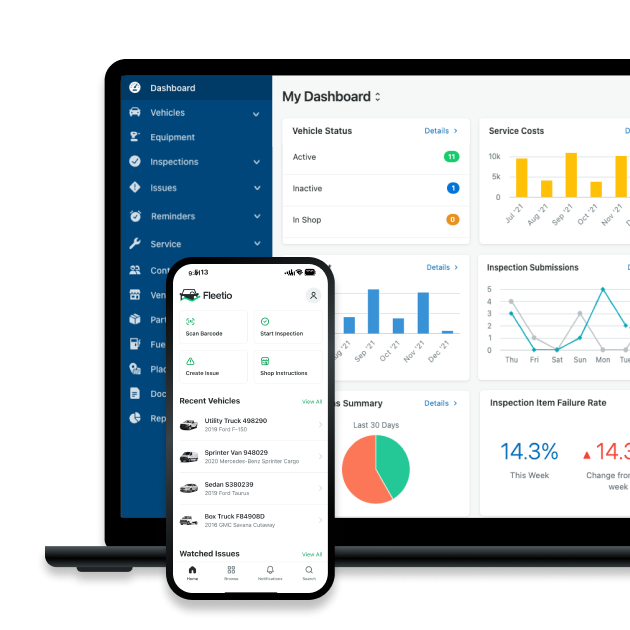
Fleet Geofencing FAQs

Fleet Content Specialist
Through interviews, blog posts and webinars, Alex covers the tactics and technologies exceptional fleet managers use to achieve results. By sharing their success stories, his work aims to inform and inspire fleet professionals of all stripes.
LinkedIn|View articles by Alex Borg
Senior Copywriter
Tyler Freeland is a Senior Copywriter at Fleetio. A former creative writer for Freightliner and Western Star, he now transforms complex (and sometimes common) fleet management topics into practical, engaging insights that fleet professionals can apply every day.
LinkedIn|View articles by Tyler FreelandReady to get started?
Join thousands of satisfied customers using Fleetio
Questions? Call us at 1-800-975-5304